How Aerial Photography Helps Track Construction Milestones
“A picture is worth a thousand words, but an aerial shot of your construction project? Priceless.”
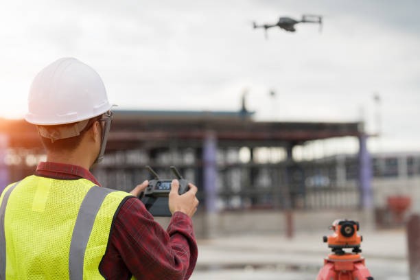
When managing a construction site, keeping track of progress is vital to ensure the project stays on schedule and within budget. One of the most effective ways to do this is by using drone construction site photography. Drones provide a bird’s-eye view of the site, capturing detailed images of the entire construction process. These aerial shots help construction managers, contractors, and clients stay updated on how the project is progressing, offering a unique perspective that ground-based photography simply cannot match.
In this blog, we’ll explore how drones for construction sites in Richmond, VA, are changing the way construction projects are monitored and tracked. From capturing progress to improving efficiency, aerial photography is becoming an essential tool for construction teams across the globe.
1. Capturing Real-Time Progress
One of the greatest benefits of using drone photography for construction sites is the ability to capture real-time progress. With drones, you can document the entire site in a single flight, providing an up-to-date snapshot of the work completed. These aerial images allow project managers to instantly assess how much of the work is done, how the site looks at different stages, and whether the project is on track.
Compared to traditional methods of tracking progress, which can involve taking photos from multiple angles on the ground, drones make it easier to capture large-scale views quickly. This provides a comprehensive overview without the need to physically inspect every part of the site.
2. Tracking Milestones from Above
Construction projects often have specific milestones that need to be met within a set timeframe. Drone photography helps track these milestones by capturing images of the site at various stages. Aerial shots can show the progress of foundation work, framing, roofing, and even landscaping, helping to ensure that each milestone is being reached as scheduled.
This type of visual tracking allows construction teams to compare the original plans with the actual progress. By flying drones over the site at regular intervals, managers can visually see if the project is progressing as planned or if adjustments need to be made. It also gives a clear visual timeline that can be used for future reference or in meetings with clients.
3. Improved Communication and Collaboration
Aerial drone photography improves communication between different teams involved in the construction project. By providing real-time aerial images, project managers, architects, and contractors can all have access to the same visual information. This reduces confusion and helps everyone stay on the same page.
For example, if an issue arises in one area of the project, aerial images can quickly highlight the problem and help the team decide on the next steps. This type of transparency fosters better collaboration and allows for quicker decision-making.
4. Minimizing Safety Risks
Construction sites can be dangerous, especially in the early stages when heavy machinery and equipment are in use. Using drones to monitor the site reduces the need for workers to access high-risk areas. Rather than sending someone up on a ladder or scaffold to take photos or monitor progress, drones can do this safely from the air.
Additionally, aerial photos can highlight potential safety hazards that may not be immediately visible from the ground. This helps construction managers take preventive action, reducing the risk of accidents on the site.
5. Documenting for Future Reference
As construction projects progress, it’s important to have a record of how things looked at different stages. Aerial drone photography provides a reliable, visual archive of the entire project. These images can be useful in the future for maintenance purposes, legal reasons, or even marketing materials.
For example, having detailed aerial shots from each phase of the project can be valuable for showing clients the progress made over time. In some cases, these photos might also be used for insurance purposes or to settle disputes related to construction timelines or quality.
6. Improved Marketing and Client Engagement
Aerial shots are also a great marketing tool. When selling or renting out a property, potential buyers or tenants appreciate being able to see the property from an aerial perspective. Drones can capture the property’s surroundings, its relation to nearby amenities, and provide a clearer view of the entire site. This can help generate interest in the property and give it a competitive edge in the market.
Furthermore, aerial footage of a construction project’s progress can be a powerful tool for engaging clients. They’ll appreciate being able to visually track the progress of their investment, leading to greater satisfaction and confidence in the construction team.
7. Cost-Effective Monitoring
Traditionally, tracking a construction project involved hiring a surveyor or other professionals to visit the site regularly. Drone photography offers a more cost-effective solution by providing a fast and efficient way to capture images. A single drone flight can cover large areas, reducing the need for multiple site visits and lowering overall costs.
Drones also reduce the need for expensive equipment like cranes or helicopters, which were previously used to capture aerial views of large construction sites. As a result, drone photography offers a more affordable, accessible option for construction site monitoring.
Key Reflections
As drone technology continues to evolve, its use in construction sites is becoming more prevalent. Drone construction site photography in Richmond, VA, is an invaluable tool for tracking milestones, improving communication, and enhancing project management. The ability to capture aerial views of a construction site provides a clearer picture of progress, reduces safety risks, and increases efficiency, all while saving time and money.
Stop relying on blurry photos and outdated site data. At Visual Advantage Drone Shows, we specialize in high-quality drone photography engineered specifically for construction projects. Our expert pilots capture every crucial moment right from groundbreaking to completion, giving you clear, detailed documentation and essential real-time insights.
Don’t let your project be left in the past. Contact us today at vadroneshows.com to schedule your drone photography session and start tracking your construction milestones with the precision and clarity you deserve!
FAQ
- How can drone photography help track construction milestones?
Drone photography allows for aerial shots of the construction site, making it easier to document progress at various stages. These images can help compare plans with actual progress, ensuring milestones are met on time.
- What are the safety benefits of using drones on construction sites?
Drones reduce the need for workers to access dangerous areas, minimizing the risk of accidents. Aerial images can also help spot potential hazards that may not be visible from the ground.
- Can drone photography help with communication on the construction site?
Yes, aerial images allow different teams, like project managers, contractors, and architects—to view the same visual data, improving communication and collaboration across the board.
- How can drones be used for marketing construction projects?
Aerial shots provide stunning visuals that can showcase the property’s surroundings, increasing interest in the project. These images are especially helpful when selling or renting out properties once construction is complete.
- Are drone services for construction projects expensive?
No, using drones for construction site photography is typically more cost-effective than traditional methods like hiring surveyors or using cranes for aerial shots. It’s a fast, affordable solution that saves time and money.